Búsqueda por categoría
Búsqueda por categoría
Búsqueda por marca
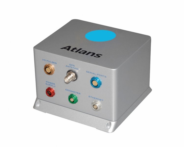
Código: IX00025
Fabricante: Ixblue

Mercados:
iXBlue combines its own high-performance fiber-optic gyroscopes (FOG) with a range of sensor types, such as global navigation satellite systems (GNSS), to produce inertial navigation systems (INS) suited to all airborne, land and underground applications, along with all vehicle applications. These highly efficient and attractively priced geo-referencing systems are capable of accurately computing position and attitude in real time and in post-processing. iXBlue products provide all the necessary data for demanding navigation and control applications. The compact and low power consuming iXBlue?s latest fiber-optic gyroscope (FOG) products allow easy integration in unmanned aerial vehicle (UAV) environment, in term of volume, weight and reliability. ATLANS-C, LANDINS and AIRINS inertial navigation systems measure, monitor and model planet earth. They are mapping and positioning solutions to large and leading providers of mobile and airborne geophysical services. Installed in airplanes or helicopters, iXBlue's airborne navigation systems are easily integrated with LIDARs, aerial cameras, synthetic aperture radars (SAR) or hyper spectral sensors for the generation of digital terrain models (DTM) or airborne photogrammetric, for example. ATLANS-C is a high-performance position and orientation system, designed specifically for land and airborne mapping applications. With its small size, low weight, low power consumption and solid-state fiber-optic inertial navigation system (INS), it provides all the necessary data for demanding superior mobile mapping applications.