Búsqueda por categoría
Búsqueda por categoría
Búsqueda por marca
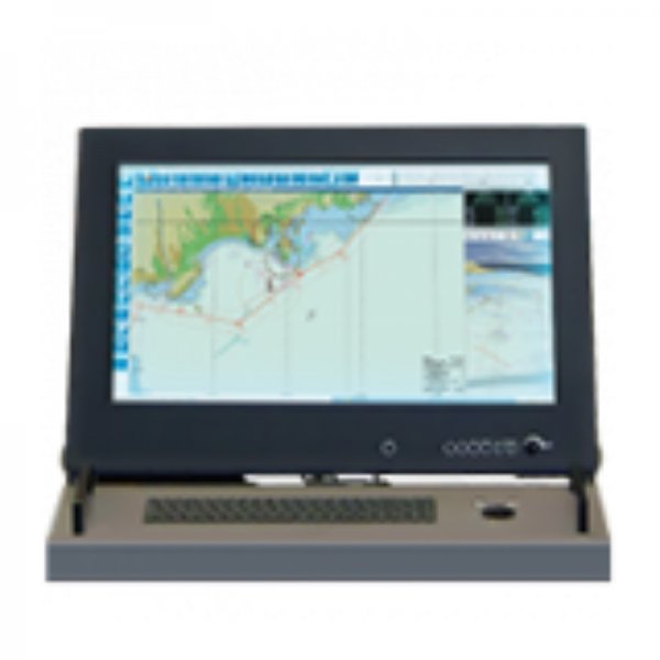
Código: IX00005
Fabricante: Ixblue

Mercados:
iXBlue global electronic chart display and information systems (GECDIS) comply with the latest IMO, IEC and IHO regulations. At the heart of the navigation and surveillance system, they monitor, process and display all the information available on board to provide the navigator with the best understanding of the vessel?s navigation environment. Our GECDIS-C (commercial-ECDIS) and GECDIS-W (warship-ECDIS) products, with GECDIS-ST tactical table, benefit from iXBlue?s nearly 30 years of experience in designing and maintaining navigation software. The GECDIS (TM) advanced software kernel provides: Sensor data acquisition - a broad range of navigation and surveillance sensors, including INS, GPS, AIS, SONAR, thermal cameras etc. Data-processing algorithm - computation, analysis and fusion algorithms on acquired data Key information layer management - endless customization of displayed map layers User experience - powerful, high-performance 2D/3D display engine and information layer management Features and Benefits: *IMO ECDIS certified *Compliant to IEC and IHO regulations *GECDIS-W compliant to WECDIS STANAG 4564 (AML...) *Multi-layer display with advanced geographic database features *Advanced information layer management and representation (2D/3D) *Availability of software development kit (SDK) for specific needs *Advanced data fusion features GECDIS-C is iXBlue electronic chart display and information system (ECDIS) which has been designed to be fully compliant with the latest IEC IMO and IHO standards and regulations.