Búsqueda por categoría
Búsqueda por categoría
Búsqueda por marca
Código: GA00045
Fabricante: Garmin

Mercados: Aire Seguridad
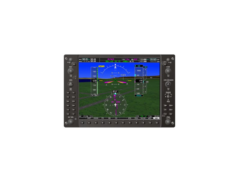
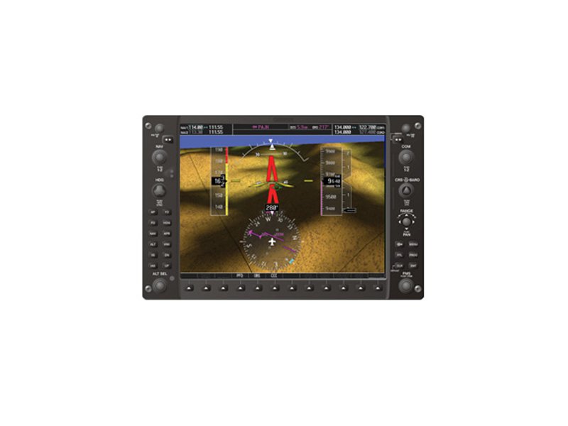
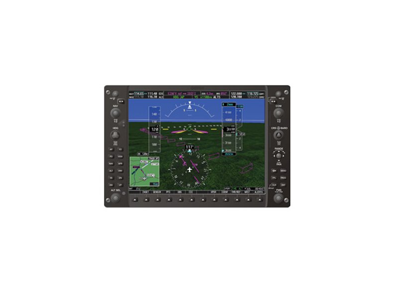
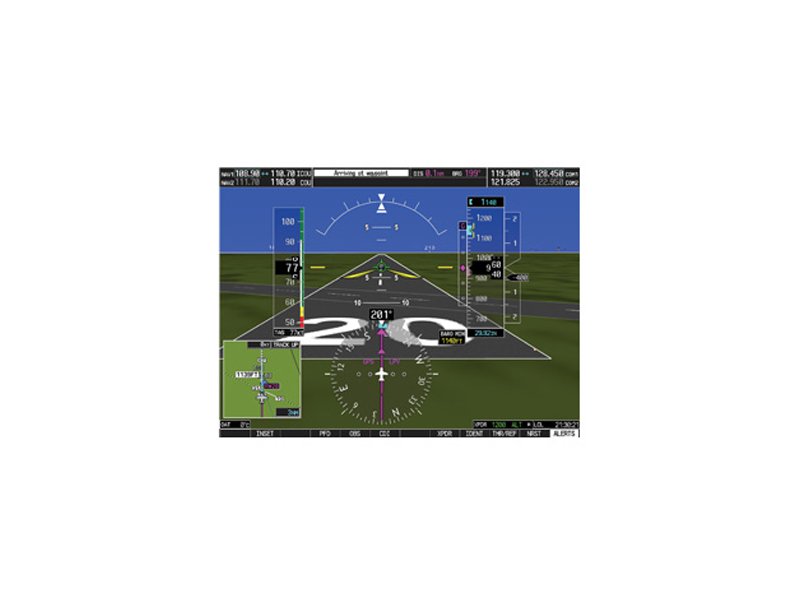
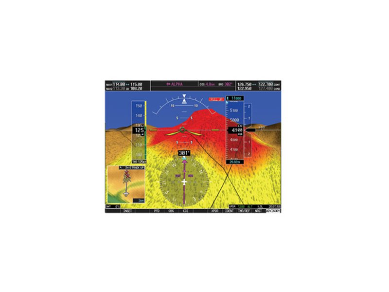
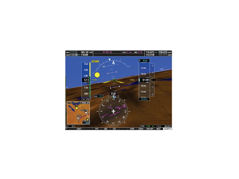
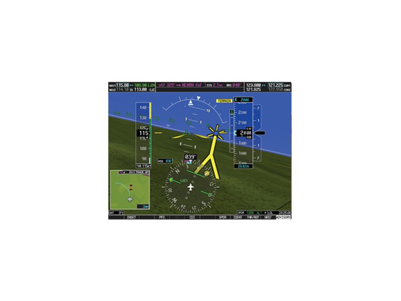
SVT for G1000 has our most useful, safety-enhancing situational display capability in an integrated flight deck. And it can make a world of difference in the way you navigate today?s busy airspace. Seeing Is Believing When darkness, fog, rain, haze or solid IFR conditions keep you from seeing clearly out the windshield, our SVT virtual flight reference is like ?taking the blinders off.? Using sophisticated graphics modeling, SVT recreates a visual topographic landscape from the G1000 system?s terrain-alerting database. The resulting virtual reality display offers pilots a supplemental 3-D depiction of ground and water features, airports, obstacles and traffic ? all shown in relative proximity to the aircraft. So situational orientation is far easier and less stressful. Fly with Added Perspective Integrated with the G1000?s primary flight display (PFD), SVT is a virtual revolution in big-picture visualization. Now, instead of a flat blue-over-brown attitude/heading reference, you?ll see an in-depth perspective view of realistic terrain features rising into the sky. It?s like looking through the PFD to monitor your flight situation, without struggling to piece together a mental picture solely from raw instrument data on the panel. See a Color-coded Landscape When flying in areas or at altitudes where rising terrain may pose a hazard, SVT uses its terrain-alerting database to colorize the landscape, clearly showing with amber or red overlays those areas where potential flight-into-terrain risks exist. Any towers or obstacles that may encroach upon the flight path are color-highlighted and clearly displayed with height-appropriate symbology. Steer Clear of Traffic SVT shows fixed terrain and obstacles, and also works with TCAS/TAS/TIS traffic technologies to depict targets in 3-D perspective, so you can visually gauge how high and how close they are. Plus, the familiar color- and shape-cued TCAS symbology grows larger as it gets nearer, making traffic conflicts easier to see and identify. Follow Pathways in the Sky In addition to identifying airports and showing runways in graphical perspective, SVT also helps simplify enroute navigation. It can create a 3-dimensional ?pathway? view on the G1000 PFD, showing enroute legs, terminal procedures, and ILS or GPS/WAAS vertical approaches ? all laid out in front of the aircraft by means of outlined ?windows? on the display. These windows vary in size to depict the flight path in perspective. And guidelines in each corner of the pathway windows point in the direction of the active flight plan leg, making it easy for you to follow the ?pathway in the sky.? Let SVT Show You the Future The vision may be synthetic, but the benefits are real. Although SVT is not intended to replace traditional attitude and directional cues as your primary flight reference, it clearly augments your view of this data by giving it a realistic visual frame of reference, so you can see at a glance where you are in relation to ground features, traffic, and the flight path entered in your navigation system. So you?re always flying with the future clearly in sight.
GA00046
GA00049